

|
|
This turned out to be the best daytime thunderstorm I have seen in 2008. After the excitement of the big shelf cloud and associated thunderstorm on the 11th I was not expecting any more severe weather action so soon but I was pleasantly surprised when another thunderstorm outlook at been issued for N. Ireland on August 13th. The main risk was general thunderstorm activity and with over 600 CAPE and a lifted index of -2 there was plenty of instability around. The only concern was the lack of vertical wind shear, however some organized storms or even the odd funnel couldn't be ruled out. I was up during the morning and could already see huge cumulus development which was a good sign. By the early afternoon I checked the radar and seen a long linear cluster of heavy showers with red echoes to my W. The sferic charts confirmed my suspicions, these were thunderstorms. I decided to head out to a country spot and chose the same good location I was at during the previous storm. The centre of a low pressure system was over N. Ireland, effectively a rotating air mass over the same wide area so I reckoned the storms would reach me over the next hour or two.
I eventually made it to my location just after 14.00 BST. The entire N to SW skyline was covered in big cu towers and along the crest of the mountain I could see a line of rainfall getting vigorous looking. The rain gradually became more intense with nice vertical striations in the curtains and the entire region began to move towards me from the SW. I was able to watch the entire storm through its complete life cycle from birth to death which was a great experience. I was only there 15 min's when I heard my first boom of angry thunder over the Sperrins to my NW. I couldn't see the storm itself because of the mountains but it wasn't more than 10 miles distant if I could hear the thunder. In the W to SW sky I kept watching the main area of interest. It must have been the period of greatest instability because suddenly those dark cu towers began to really shoot up and explode with energy with nasty looking plumes on top, all accompanied by rumbles of thunder from the NW which were gradually getting louder and more frequent. These towers along the mountain tilted over in spectacular fashion to the N so there was good wind shear after all, this was going to get organized. The cu formed a long line across the sky one behind the other like cars in a traffic jam then they merged together and formed a large structure. After some time that line became a curved gust front and huge core of rain opened up over the Sperrins. This was now turning into an organized thunderstorm. The other storm to the NW arrived over the mountain crest with an intense rain core and continued booming loud and long duration rumbles. The other system began to produce its own thunder then both storms began to get very lively indeed!.
 |
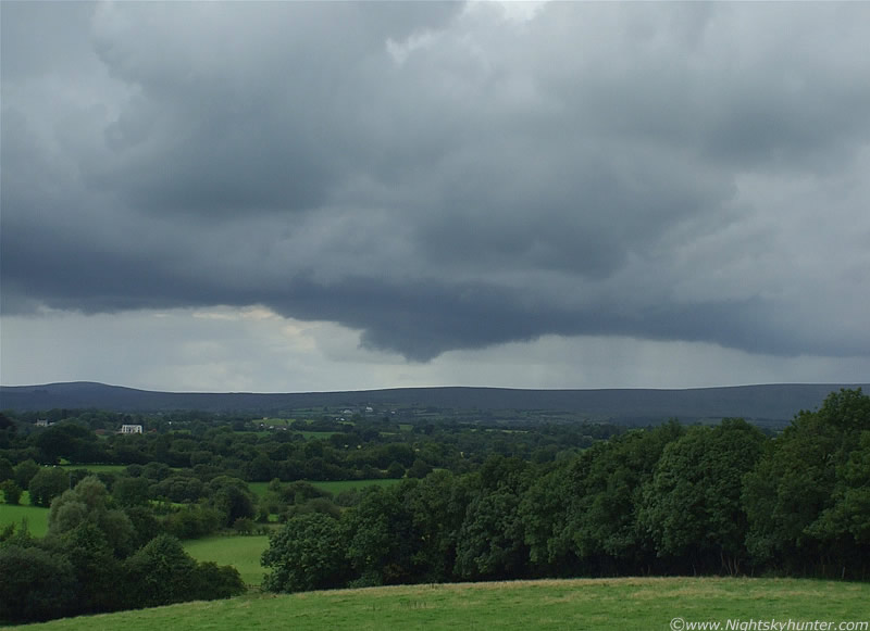
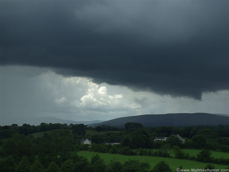
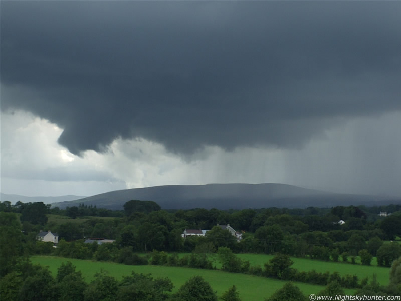
Early shot looking SW at the first storm organizing. The early stages of a growing shelf cloud can be seen to the L.
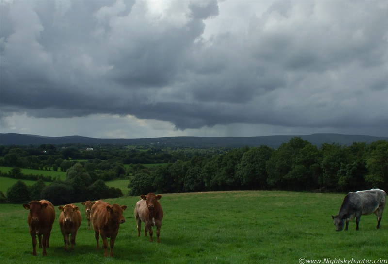 |
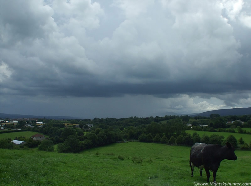
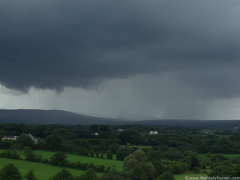
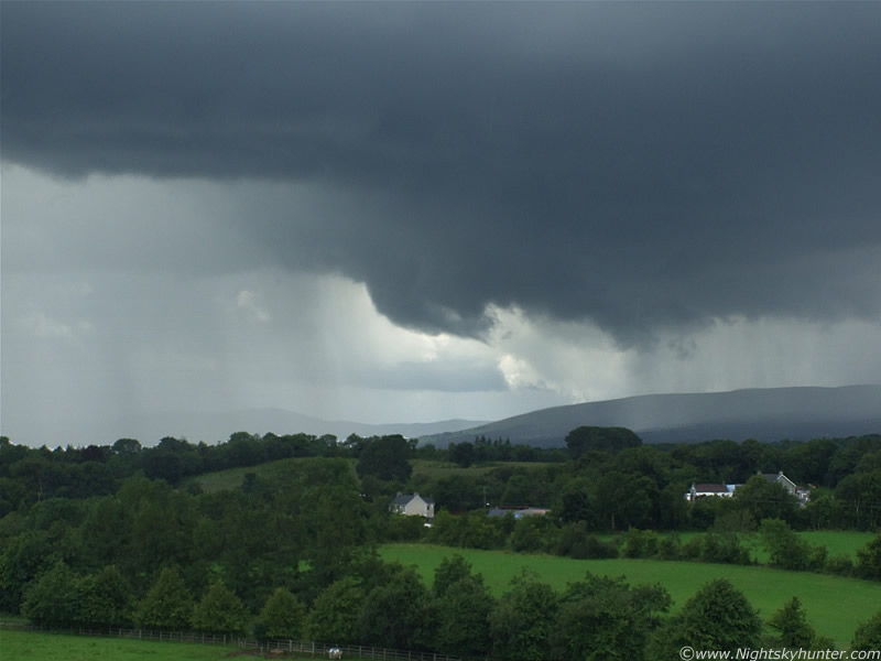
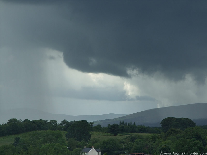
This is looking NW at an earlier stage. You can see the line of cu towers over the mountains with obvious tilt (shear). They slowly moved from R to L and joined together into a storm. Interesting lowering under one of them to. You can just about see some of the rain fall to the R over the mountain which is the NW storm approaching. Loud thunder was rumbling away in that area and out of frame to the R (N). Those Cows stood there for a long time just staring at me.
 |
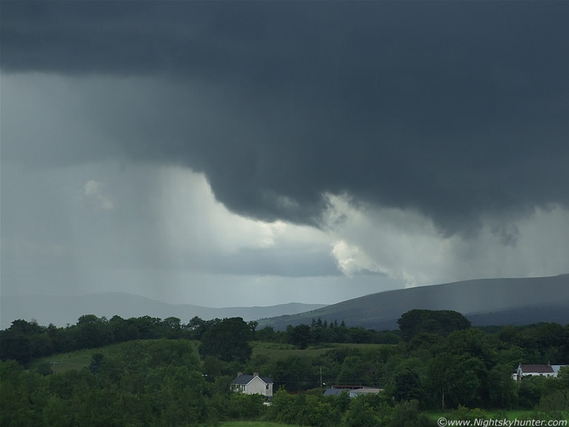
Closer in on that lowering over the hills. A period of long observation showed this to be a wall cloud. It was doing alot of moving and churning with energy.
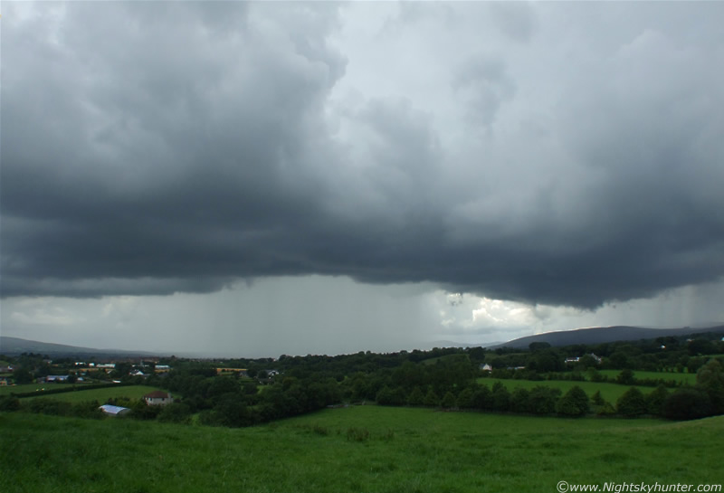 |
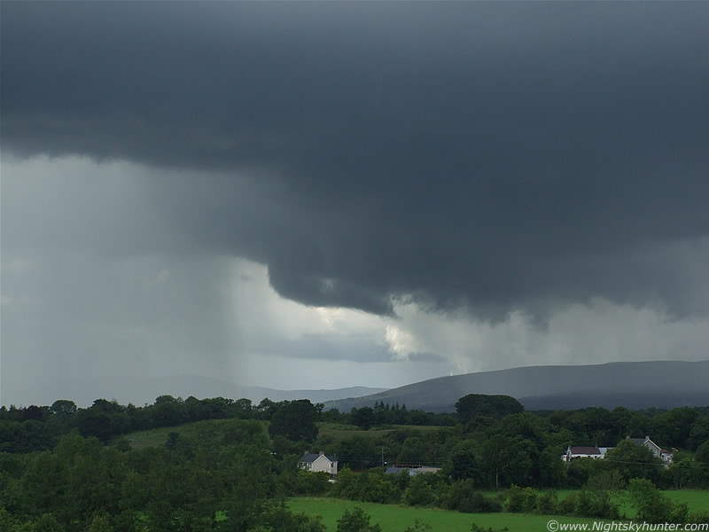
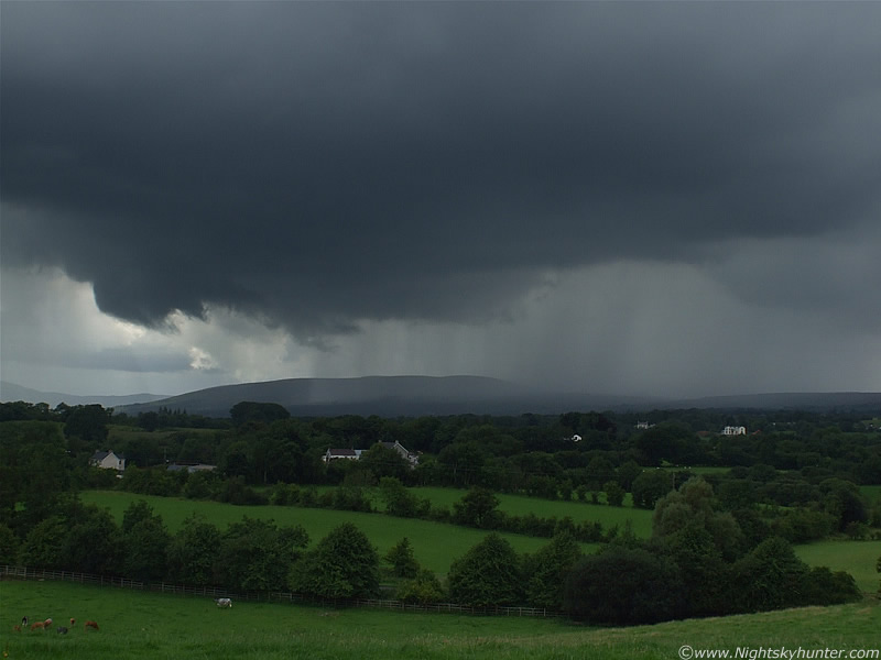
Looking SW a little later at the new storm which formed out of the above cu. The other storm is to the R. The rainfall from the primary storm has now become intense over the mountains, and because the storm was so slow moving it would have caused severe flooding. For a long period it even seemed to be stationary. I wouldn't like to be a hiker out there. I found out later from the UKWW that the radar was very impressive here showing multiple red and white returns and the sferics were going crazy. The storm quickly increased in intensity. The lightning was more frequent and the thunder very menacing. The leading rim (shelf) was getting better structured by the min. The storm is moving R to L here and towards me at the same time. Sperrins to the R and centre, and the W slope of Slieve Gallion to the far L. Cloud to ground (c-g) lightning fired down at incredible speed inside the rain core and a few intra cloud (I-C) bolts shot out from the rim on my side from the centre and R. These looked cool, several like daggers shooting across the cloud in horizontal fashion and others shooting up with a nice curve sporting tiny branches. The area to the R between the two storms was getting very interesting indeed. The real sky was darker than this but I had to use a longer shutter to get the intensity of the rain core.
 |
Zooming into the W. Portion of dark shelf from the storm is above and in the distance a flanking line of updraughts can be seen in a clearance feeding into the rear of the storm.
Here's some video footage showing the earlier stage of the storm, from the cu to storm maturity. Around 45 sec's into the clip you can see a small funnel cloud from the first storm. More about that in a min. At 1 min 59 sec's you can see the amazing precipitation core at it's finest. Note the cool structure under the gust front to the L, which at the time was over Maghera. The storm is closer than it seems because I was using the wide angle lens.
 |
Storm is in high gear now producing bolts and thunder all over the place. This is the area which would soon cause me great excitement. The rear, or 'rain free base' (RFB) of the first storm is to the L, and rain core from the other storm is to the R. The distant group of trees on the mountain is a distinctive land mark here. It can be seen at the top of the Glen Shane Pass. Just after I took this image a gorgeous white c-g shot out from the base at an angle and hit the ground to the R.
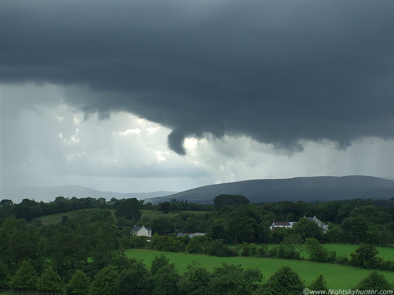 |
As if the thunderstorm was not exciting enough I got treated to some amazing sights from the RFB of the first storm. Over a period of 10 min's I witnessed three good funnel clouds. The first was a classic tuba-like cylinder rotating, it looked like someone had cut the end off with a saw, it was that well defined. It didn't last long then went back up to the cloud. This was followed by an even nicer funnel which looked like a black ice-cream cone with smooth sides. Both could be seen spinning but were short-lived affairs. I never took my eyes of that region from then on. A few min's later funnel number three formed and I was beside myself with excitement. A shallow but strong wall cloud formed and out from it came, what I can only describe, as a big black slug. Or even better, a snail emerging out from its shell. The way it formed out of the storm was exactly like the early stages of the spectacular one I saw in 2007. This massive form just dropped out and began twisting and rotating in a strange manner. I couldn't believe my eyes!. In a state of panic I began taking still images and video footage. Good job I brought the tripod along. This image shows the funnel extending down into a hook shape, all the time twisting. This is only about 1/2 mile or so away from me. It was directly W hanging over the Sperrins. The funnel looked very big with the naked eye and was an abrupt eye-catching sight over the mountain. It extended down almost half way to the ground then began to quickly bend back on itself.
 |
Look how big this is. It was constantly changing shape and even in this still image you can sense the rotation. It was much blacker looking in reality. It reminded me of a big slug, even the spikes of cloud extending out from its side reminded me of antennae.
 |
Wide shot. The two storms where merging together at this point. The Coleraine Road runs through here in front of those houses so much of the traffic must have seen this, however they may not have recognized it for what it was because it's not the conventional type of funnel people have in their minds. More bolts fired down from the rain curtain not far from those houses. Above me I could see the huge black towers of the storm blooming wide.
 |
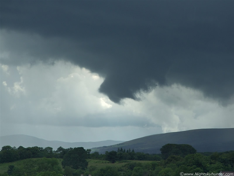
To the naked eye this looked incredible. Both storms have now merged together with two precip cores either side of the funnel. Before this the funnel looked like a tortured black lump, indecisive about what to do next, then it formed into the classic 'tornadic' shape as a big stream-lined funnel with smooth edges. Very broad at the base and tapering at the end. It tilted upward into a strong curve and positioned itself into a horizontal position presumably due to updraught/inflow air pushing the funnel up. The tip is now elongated and pointing away from me to the W. A long, dark, finer condensation tube began to extend out from the snout, all the while rotating. It was incredible to watch. Thunder and lightning beside it really added to the amazing atmosphere.
 |
The inflow winds getting sucked into the storm between the two mountains must have been strong to lift this thing back up. At this point in time I was hoping it would tilt back into a vertical position, if it did, it would have looked awesome and would not doubt come close to a touch down. It stayed horizontal though. The thin R side was extending out and seemed to flicker at the end like a snake tongue. The big collar and bend to the funnel on the L could be seen twisting.
 |
Entire funnel is knocked up against the base of the storm. It is more substantial in form but scud is partially hiding its cool shape.
 |
Closer in using the zoom lens. It's making contact with the storm base now. Funnel is bent to a 90 degree angle now pointing to the R (N). Earlier it pointed W.
 |
This strange funnel retreated back into the wall cloud and vanished. Soon that area became rain wrapped and I lost it from view. I observed it for about 5 min's. I was so lucky to have been positioned to the E of the storm to see the RFB. If I had been W, S , SW, or NW I would never have known it was there because the rain curtains would have obscured it. I can tell you that seeing this in the flesh before your very eyes in a thunderstorm is incredible. I couldn't believe that I had just seen my 8th funnel cloud in just over a year. In fact, this is my 2nd funnel in 11 days!. Each funnel brings with it its own fond memories and I would rate this one as my second best. You had to have been there to experience it. This is also the 2nd time I have seen a funnel in a horizontal position. Note the cut-off point to that rain curtain under storm two!. The above image is more natural and shows the dark colour of the vortex.
Here's some video footage I took. Compression destroys the finer detail and motion, however in the high resolution original you can the rotation and a long snout growing out of the bottom. If you look closely at the two zoomed in clips you will see the rotation and horizontal growth of the funnel. There's a short I-C bolt at 40 sec's near the funnel. Looking back on it now I wonder why I didn't take more video. I always favour still images over video because of the higher quality so I make those a major priority. The camera was on the tripod, there where c-g's hitting down and loud thunder, I was trying to get focused for some images then changing the settings to get video which is not easy with my camera because of the auto focus in AVI mode, then back to stills, while at the same time watching the funnel and storm visually. There's a lot for your mind to take in. More on page 2.
Martin McKenna